Torfajökull caldera, icelandEUROPEsep 2025Laugavegur Trail
Landmannalaugar
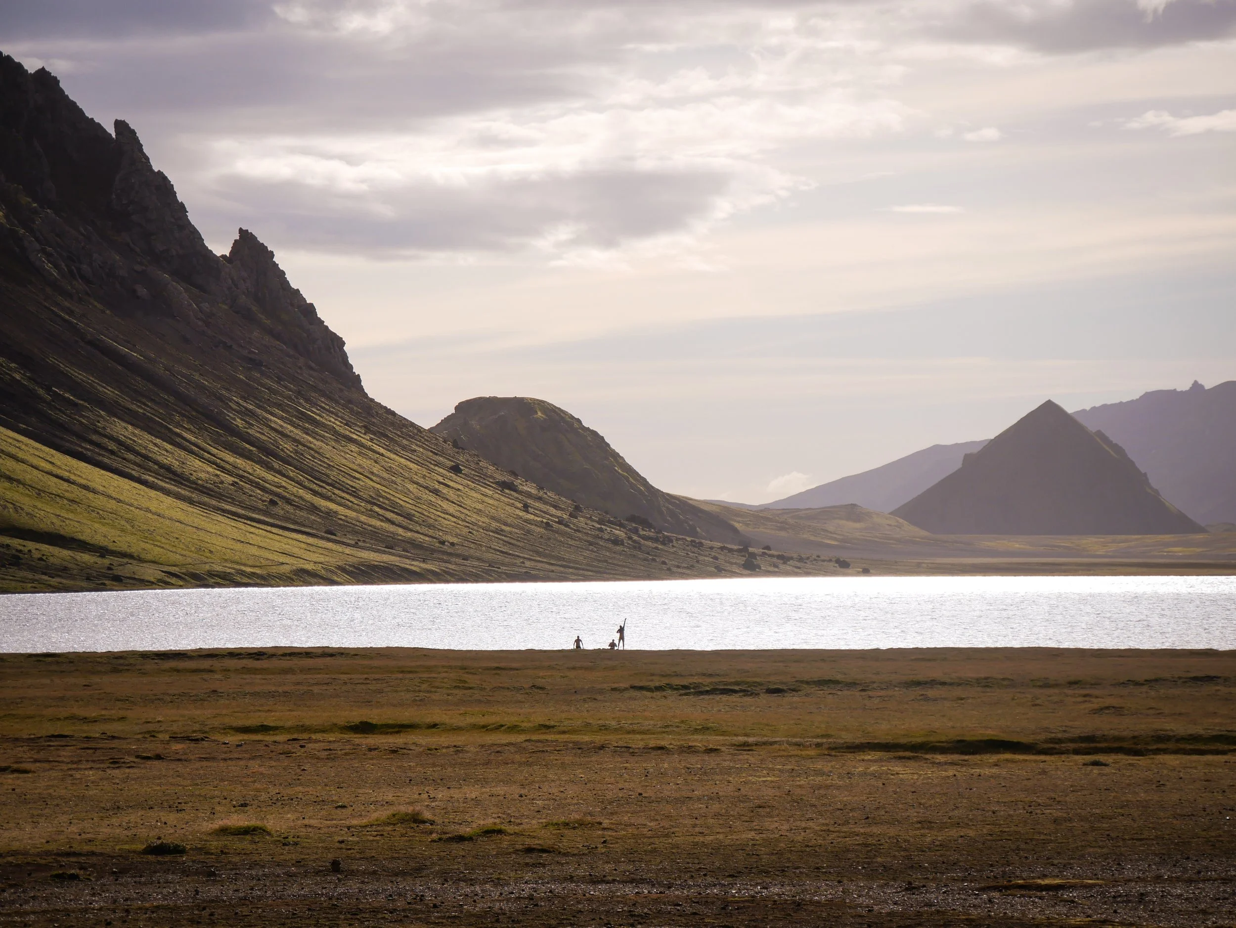
Álftavatn
Markarfljótsgljúfur Canyon
Laugahraun lava field
To say that Iceland is otherworldly is an understatement. Film productions use the landscapes to emulate planets and historical eras such as Game of Thrones. Most interestingly, more than half the population of the Land of Fire and Ice believe in elves, sometimes known as the Hidden People. And I started to believe as well. Trekking across the top of Iceland, the geothermal mists and steam vents had me seeing things.
The Central Highlands of Iceland are of The Sublime. As American climber John Harlin III stated years ago, "Today we often confuse the term with 'wonderful,' and writers and climbers do that too. But The Sublime is an appreciation for nature in its most numinous, awe-inspiring sense. It is more powerful than mere beauty; you feel like you're under the influence of something bigger than you. You feel the scale and power. It is intimidating and thrilling at the same time. It's not something that can be understood academically or through reading books; it must be experienced."
To experience The Sublime and get to my starting point at Landmannalaugar in the Central Highlands you have to criss-cross glacial rivers and deep pools. Not any 4x4 can traverse these, only very modified amphibious vehicles can safely do so. Known as F-roads in Iceland, these extreme backcountry routes can be very dangerous and illegal for standard vehicles, and for good reason. Seeing my first stranded 4x4 being hauled out by Search and Rescue proved that.
Landmannalaugar
Bláhnúkur (‘Blue Peak’)
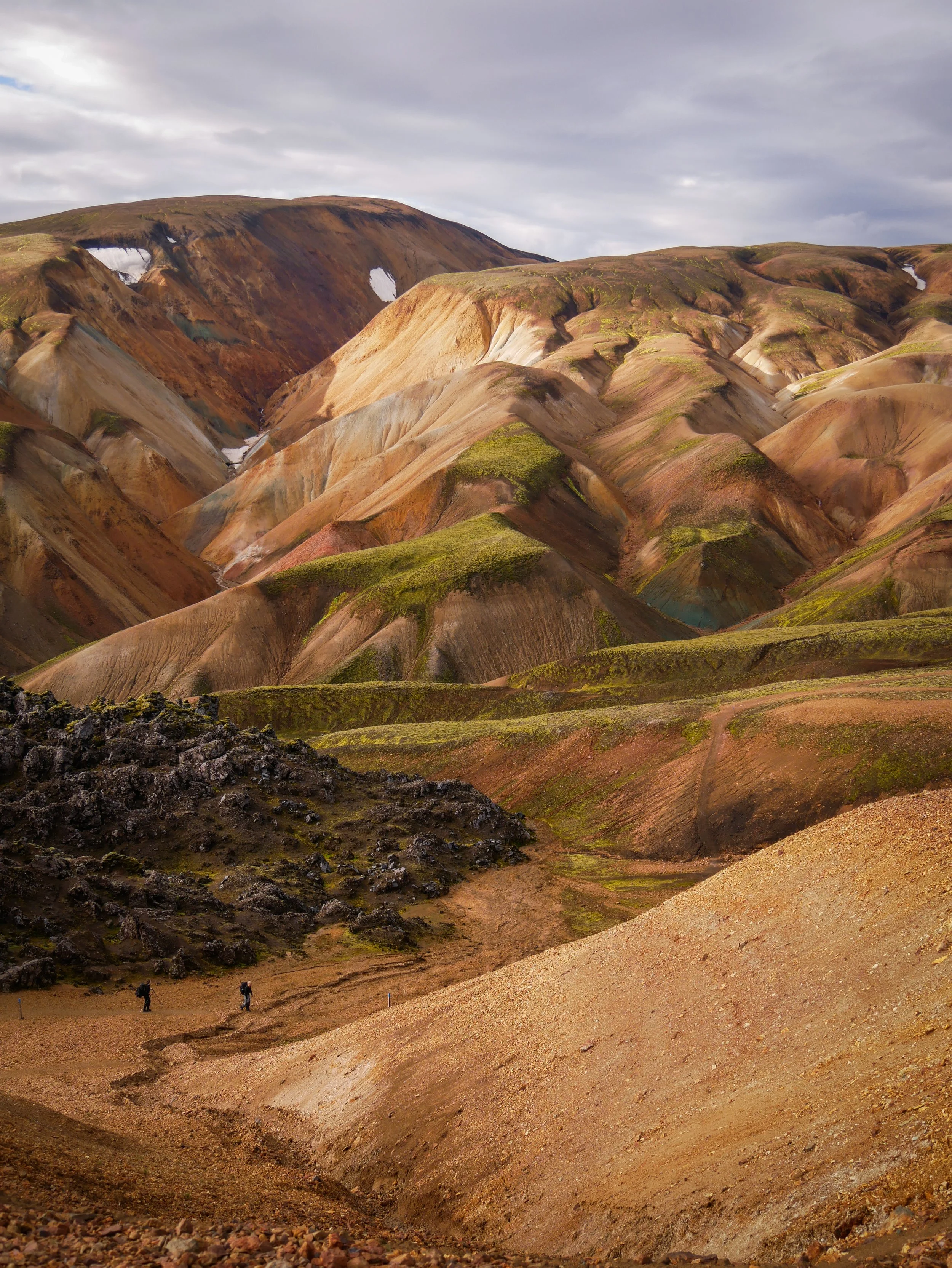
Almost 10 years ago I had hiked up from Skógafoss, past more than a dozen waterfalls on the Fimmvörðuháls and the southern starting point of the Laugavegur Trail. I always vowed to return and trek the rest of this amazing trail. You ford glacial streams, hike across black sand deserts, through lava fields, around bubbling mudpots and steaming geothermal vents, all against the backdrop of rainbow-coloured rhyolite mountains.
***
Once again, I’m reminded how the start of any adventure finds you landing in a major centre of a particular culture. In this case I landed in Keflavík just outside Reykjavik. Cobbled streets in the more historic part of Reykjavik and Skólavörðustígur, the rainbow road are a far cry from slogging through the shifting sands of Mælifellssandur in a sideways rain. And then there’s always the culture shock of returning to see so many people in a bustling town, with all the sites and sounds of a big city. You long for the solitude again.
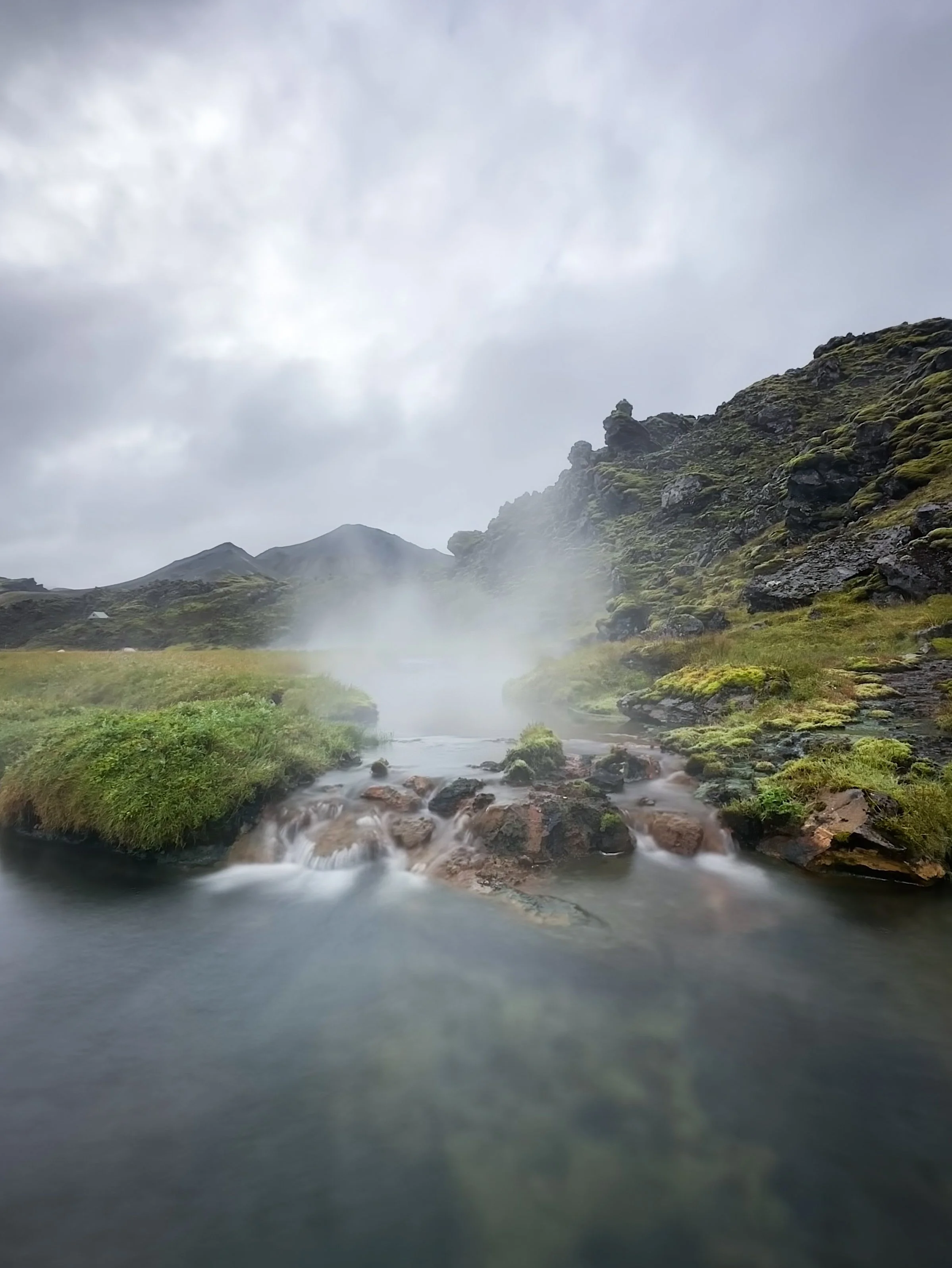
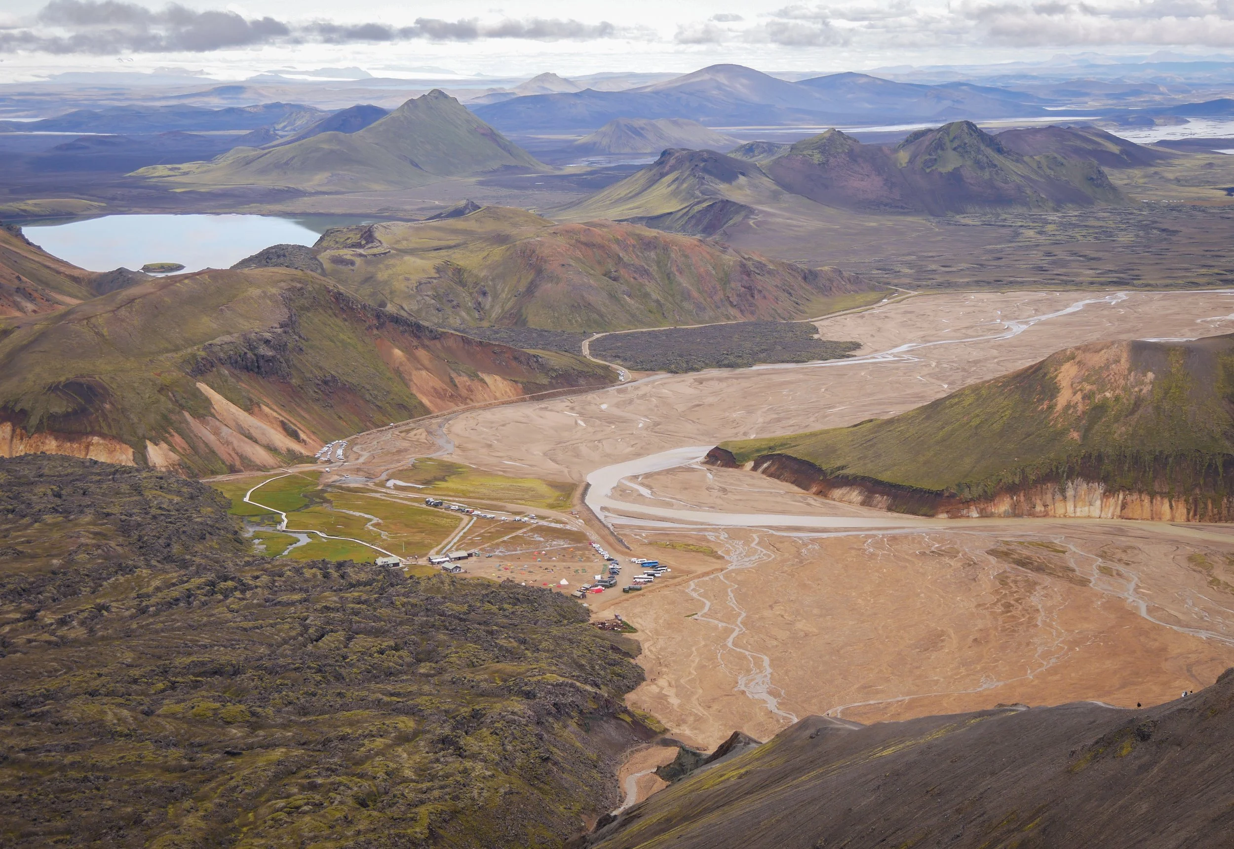
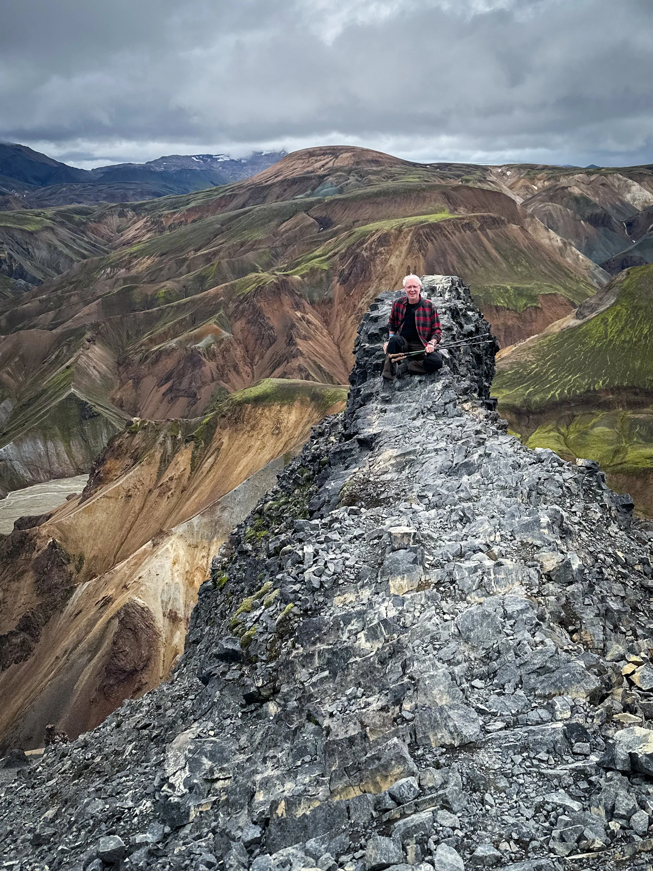
Upon arrival at the northern terminus of this trail and settling into the main hut at Landmannalaugar, I elected to hike up nearby Bláhnúkur (‘Blue Peak’). At almost 1000 meters, it made for a strenuously good day hike and practice run before starting the more serious multi-day Laugavegur (the ‘way of the water’) Trail. I booked the hut here for a couple of nights to account for jet lag and soak in the natural hot springs before starting out. Things got a bit desperate when flooding in the area days before had people evacuated but also ruined the septic field, systematically closing the washrooms one by one until the large visiting contingent were forced to use the winter latrines.
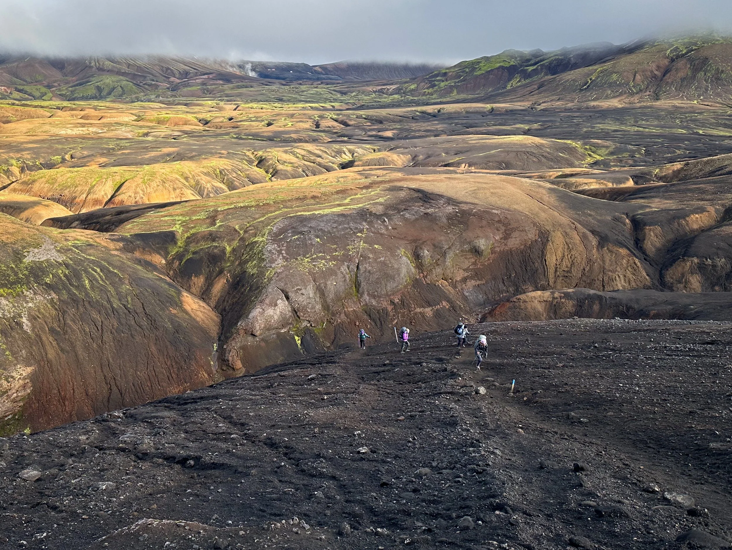
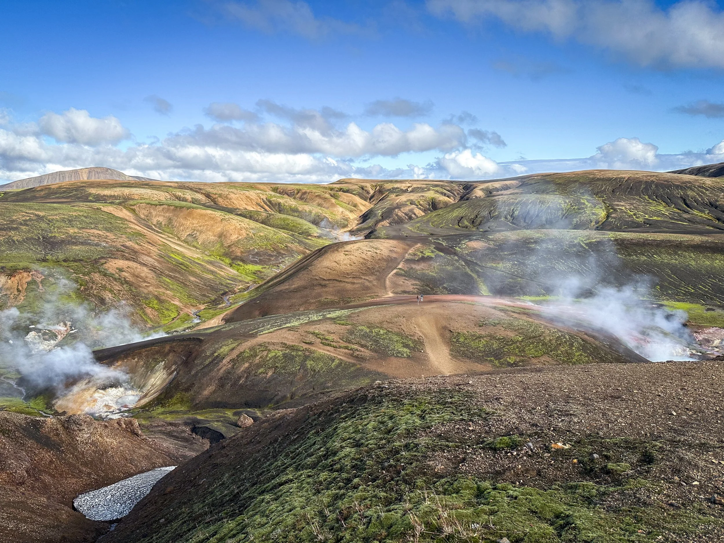
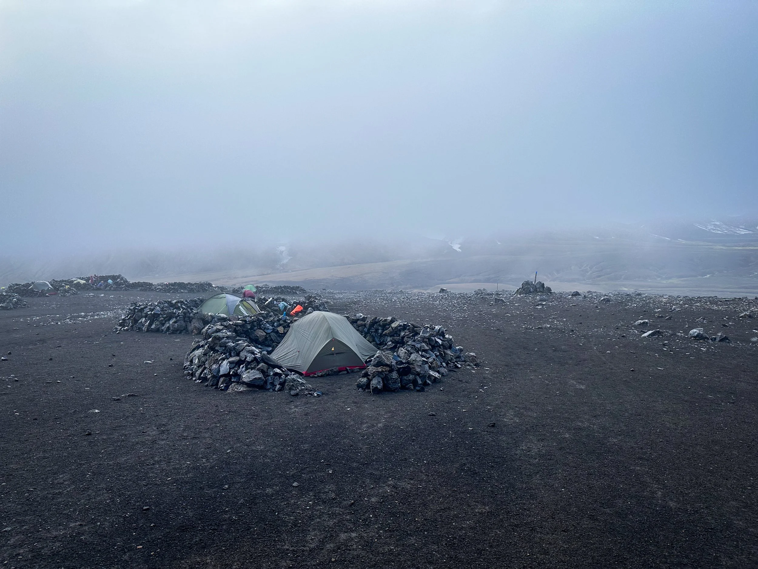
Day One of the official Laugavegur Trail finds you departing Landmannalaugar, zigzagging up through the Laugahraun lava field. Continuing past Brennisteinsalda with final views of the valley below you enter the geothermal zone of Storihver and its numerous fumaroles or steaming thermal vents. Lastly, you pass through the sparkling black obsidian fields of the Fjallabak Nature Reserve before reaching Hrafntinnusker and the first hut on this 55km trail. After all the ups and downs, this is one of the biggest days with almost 750 meters of various elevation gain. Each segment of the trail between huts is roughly 15 km.
Storihver
Arriving early and hoping to get cellular service, I did the side hike up nearby Söðull hill with panoramic views of the entire area. Exposed with a cold wind blowing, I let my family know I’d arrived safely to the first hut and quickly found cover back down the trail.
One advantage of getting to each hut early was the choice of bunk. With everyone crammed in, I didn’t want to be near the kitchen area or doors/stairs. After living through a pandemic I can’t pretend I wasn’t nervous about these tight living quarters.
Later the warden gathers everyone around in the evening to present some of the geography and history of the immediate area and of course tell Icelandic tales of those who were warned about pocketing fragments of shiny obsidian in the nature reserve, only to suffer the worst of luck. I quietly deposited my shard while departing the next day fearing a troll might tackle me along route. I’d read the Hobbit and knew what could happen!
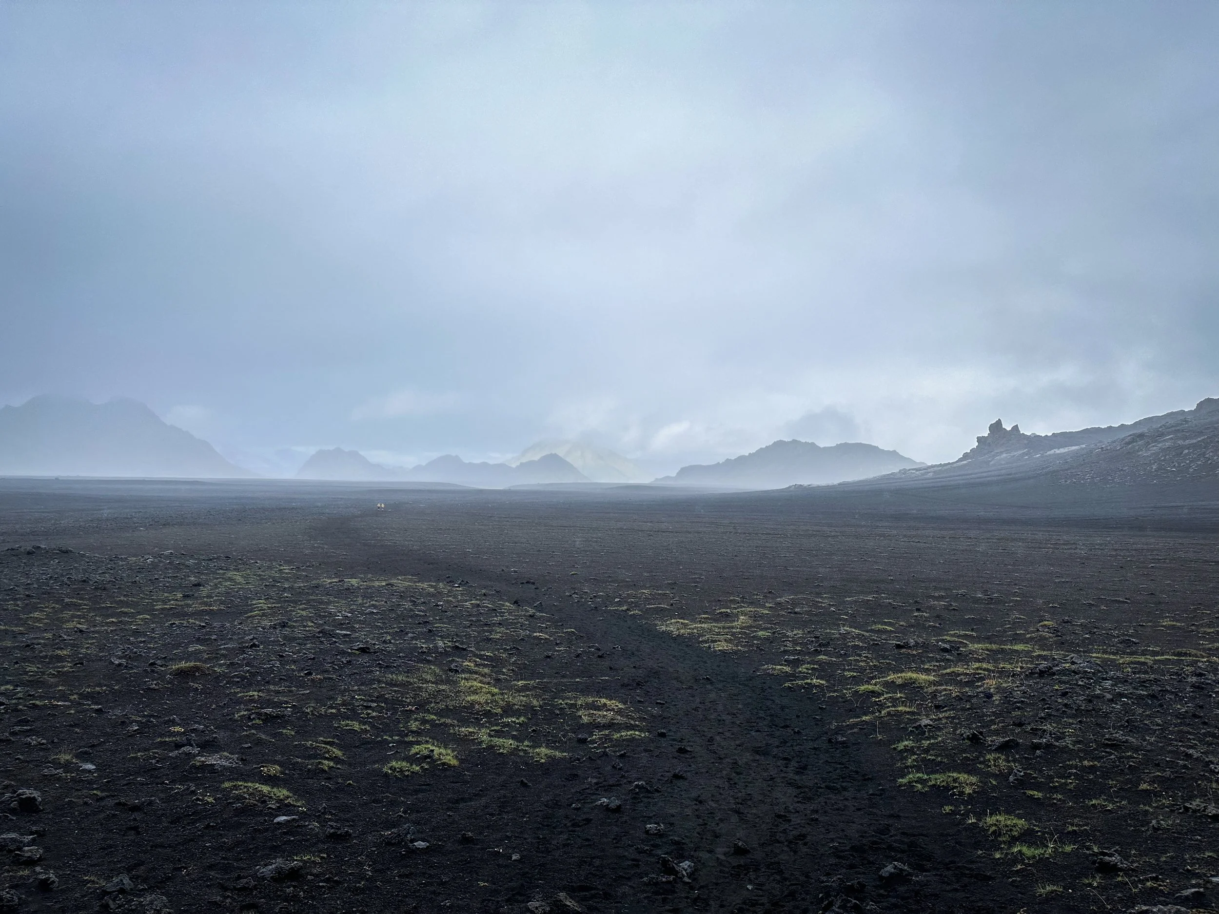
Day Two I woke shrouded in fog, surprisingly not a mental fog after the exertion the previous day but having completely lost my physical bearings which direction I was heading that day, barely seeing past my nose. Following the posted signs and periodic markers, I jostled southwesterly up and down the ravines of the Torfajökull caldera beyond Hrafntinnusker, continuing on past Kaldaklofsfjöll. From this vantage point you can see the three glaciers of Mýrdalsjökull, Eyjafjallajökull, and Tindfjallajökull.
Hrafntinnusker
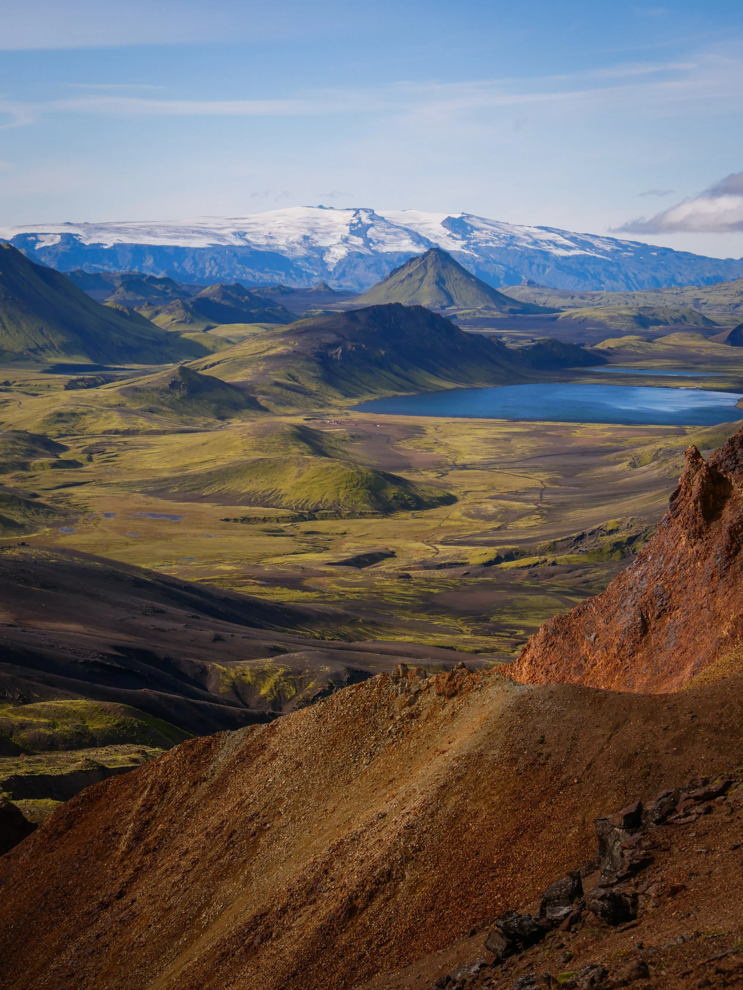
Descending the heights of Jökultungur you begin to see your next destination and second hut at Álftavatn far, far off in the distance beside the lake. Each hour passes and I somehow feel no closer. Are the Hidden People playing tricks on me? Why am I moving and the landscape not? It’s impossible to gain any perspective on the landmarks without trees or buildings to judge by. Scale and distance is all relative.
Finally arriving and checking in with the warden, I choose my sleeping pad and stretch out on my sleeping bag. The winds are really howling in this open space across the lake, but later I manage to find a sheltered spot in the sun against the lake side of the hut, to take off my boots and relax. Off in the distance, I watched as 3 of the hut guests took a cold-water plunge. After fording these glacial rivers along the trail, the lake would be too cold and exposed for my liking.
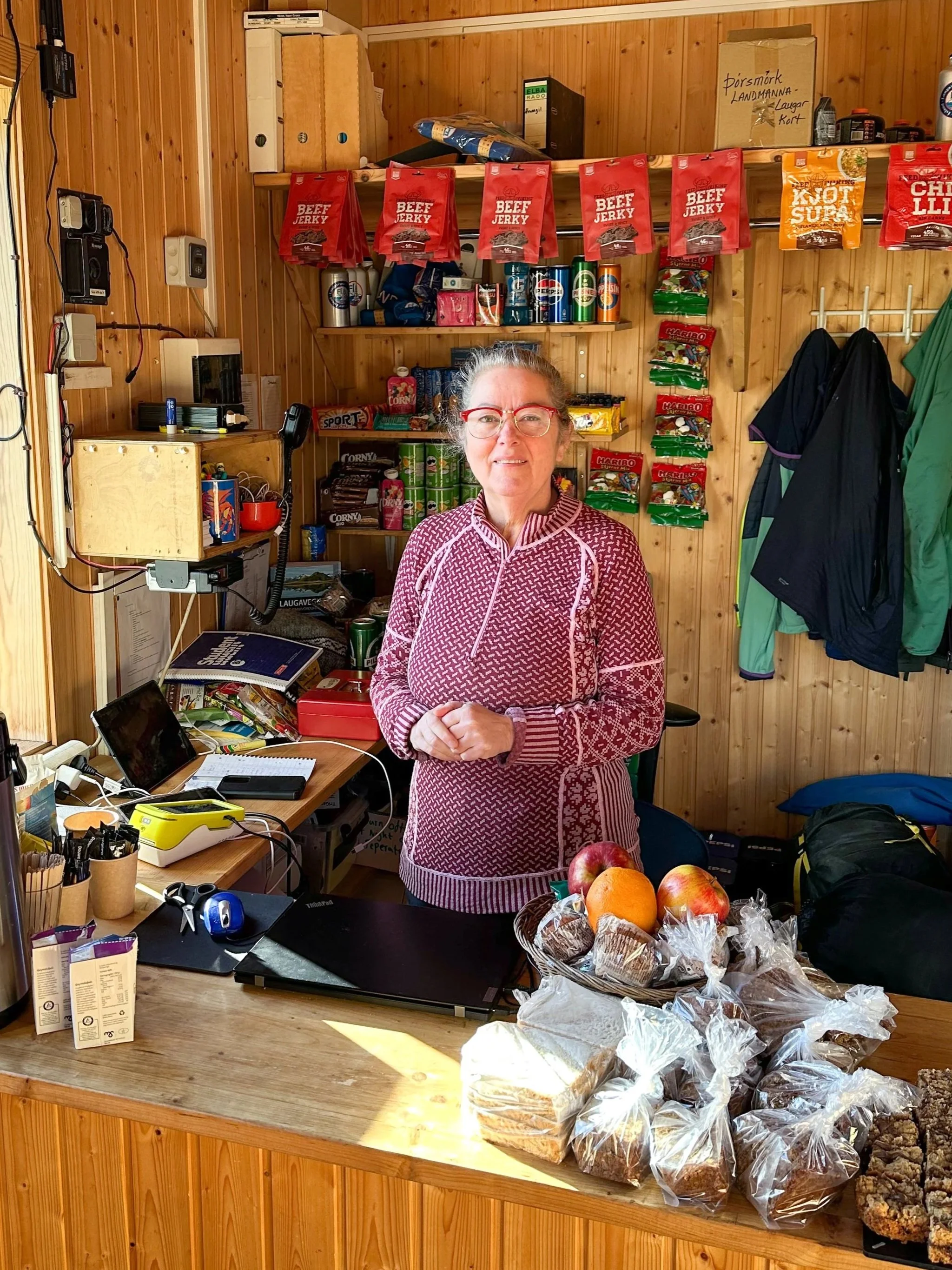
Day Three is the day for some serious river crossings. But the highlight at the half-way mark of this adventure and in the middle of absolutely nowhere was enjoying tea and cake just 4 km down the road at the Hvanngil hut, baked by the warden’s wife. After roughing it for a few days, there was nothing more civilized (and appreciated) than having warm tea and cake. I grabbed a bag of sliced dessert loaf, with pieces for later on the trail.
Shortly after leaving Hvanngil there is a small foot bridge followed by the first big river crossing of the day at Bláfjallakvísl. The warden had posted a drawing of the safest place to ford this river, based on recent flow and currents – very helpful. The land and water is always shifting in the geothermal highlands.
As I crest yet another high point, I’m awed with each new vista. After mostly blue skies, it was time to cross the black sands of Mælifellssandur. It was here the weather really changed, with no protection being so exposed. I dropped down into this valley with sideways rain chasing me south towards the hut at Emstrur.
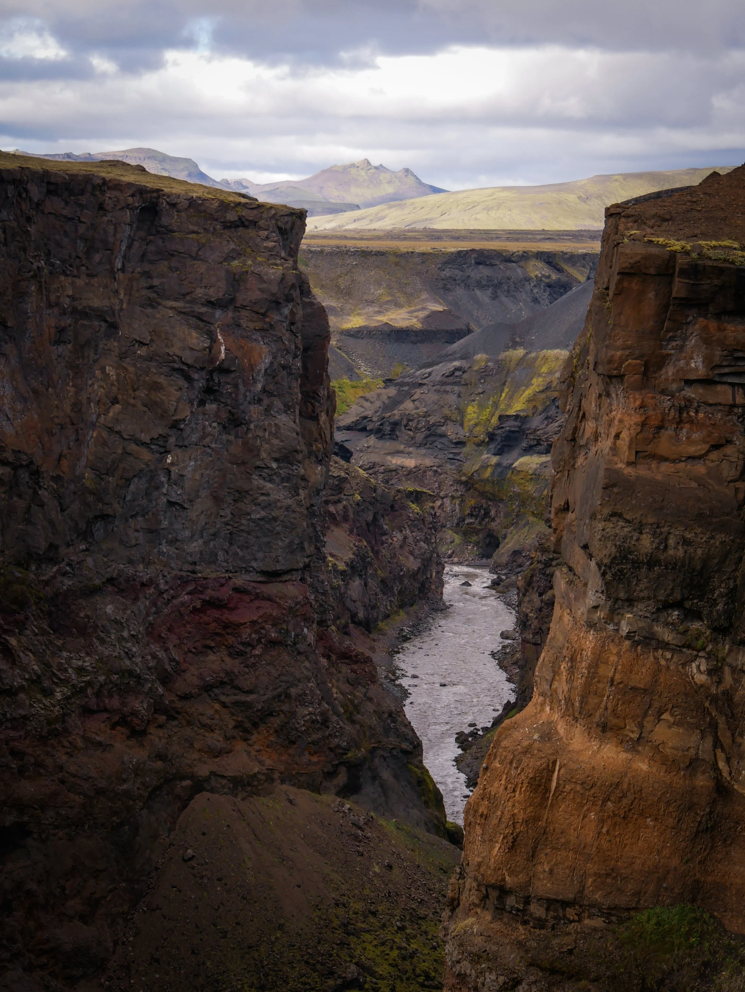
Arriving at the Botnar hut in Emstrur was a welcome relief after the foul weather that day. I managed to cover the 16 km in good time and checked in around 12:30 pm. Exhausted, I must have blacked out after unrolling my sleeping bag and woke to a noisy group of hikers setting off to explore the nearby Markarfljótsgljúfur canyon. I almost didn’t go, thinking I didn’t have the energy for another side hike. But nce again, I was stunned by yet another majestic Icelandic vista. And to think I’d almost passed on going with the group? After the flat sand desert of Mælifellssandur, this dramatic 200 meter gorge was so unexpected, carved out over the millennia and a testament to the power of mother nature

Álftavatn
Mælifellssandur
Hvanngil
Álftavatn
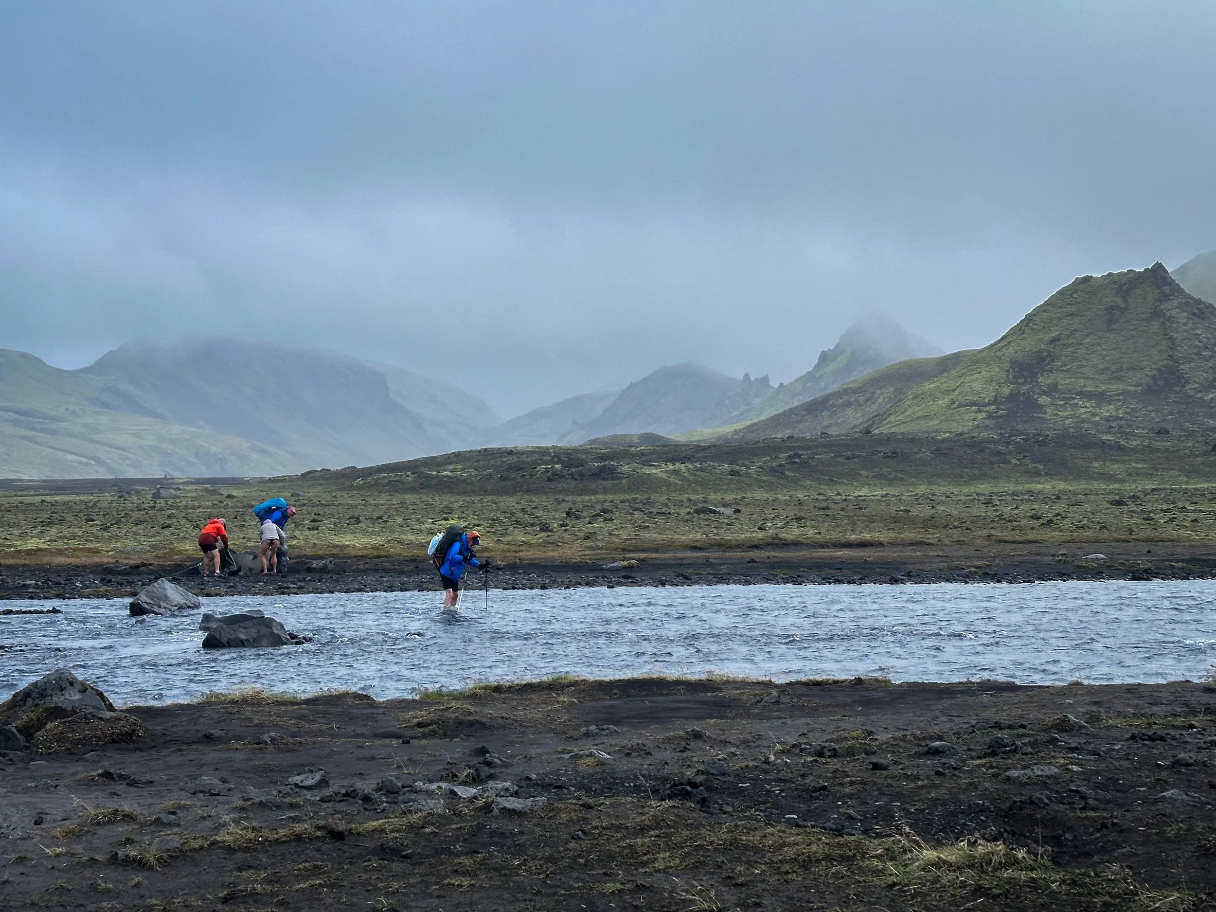
Bláfjallakvísl River
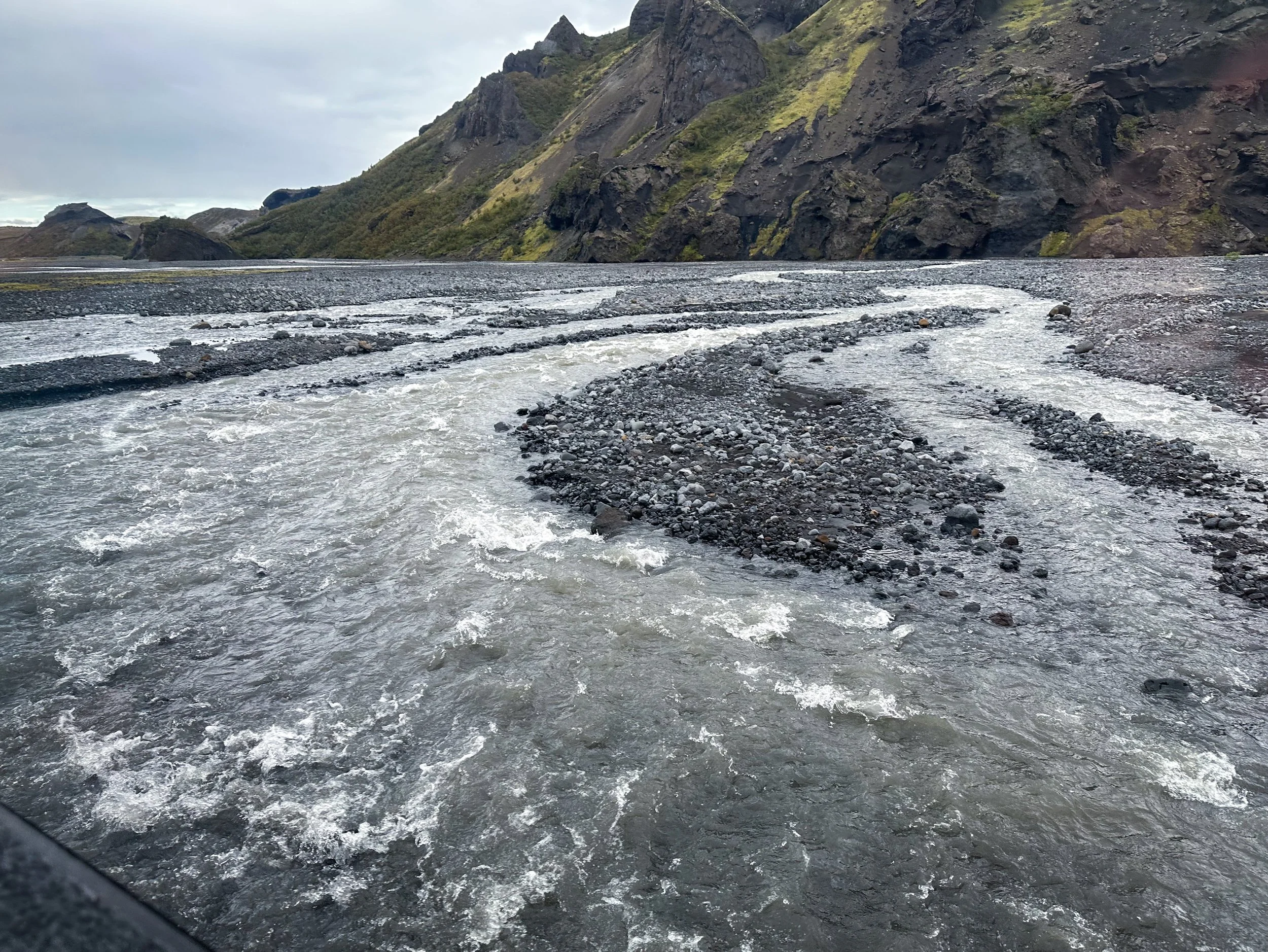
My Final Day and 15 km push to Þórsmörk started early, crossing a number of smaller rivers with footbridges. This segment had the most variety of landscapes – canyons and ravines to lush forests. But I also had to cross the Þröngá river, the most treacherous on the trail. Even this late in the season the current was strong and fast flowing, and you slowly had to concentrate on each step glad for the use of both hiking poles. These rivers were numbingly cold but somehow always felt refreshing after the initial shock.
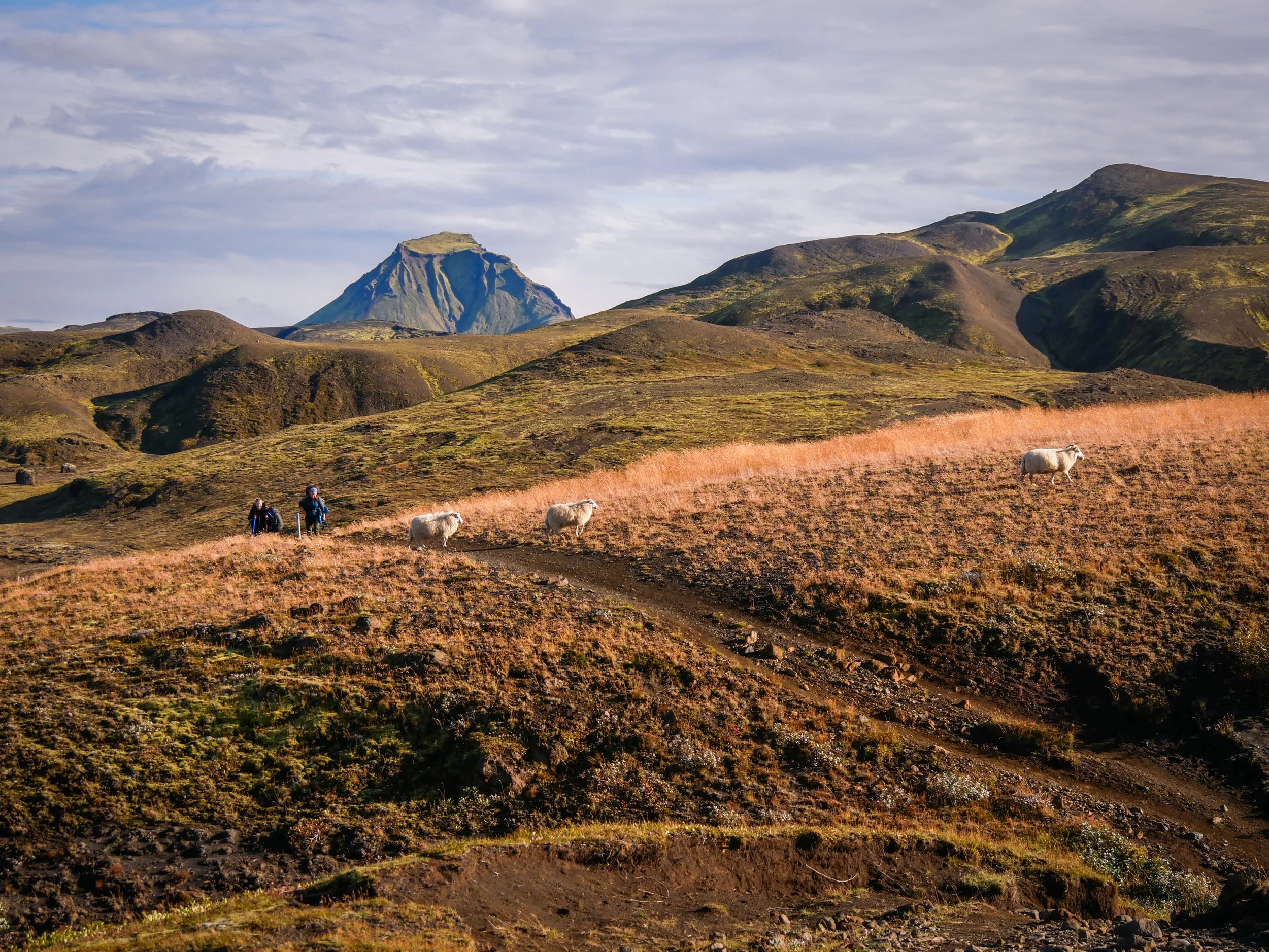
Towards the end, the trail began to meander through the Hamraskógar forest as I made the final approach through the Langidalur valley into Þórsmörk. Being from the Pacific Northwest of North America, I’m used to seeing towering fir and cedar growing hundreds of feet high. These lush birch forests were still only just above my head but having seen very little vegetation the last few days, it was nice to see some life.
Upon completion at Þórsmörk, I checked in. Content and exhausted, I sat outside the warden hut taking in my surroundings celebrating with Pringle chips and Appelsin, a favourite Icelandic orange pop - something I wouldn’t normally dream of doing. At this point, nothing surprised me.
When I asked one of the wardens about climate change, she pointed to a high tabletop feature to the south and commented that glaciated feature never used to be visible like that towards the end of summer, now it was fully exposed. Climate change is affecting even the ‘land of ice’.
Þórsmörk
Krossa River
One of the other solo hikers I’d gotten to know on this adventure had decided they wanted to continue on up and over the Fimmvörðuháls, between the Eyjafjallajökull and Mýrdalsjökull glaciers, all the way to Skógar. On my last day I suddenly realized I had accidentally booked return transportation to Reykjavik back from the original start at Landmannalaugar. Two fellow hikers from Virginia laughed and said I’d better turn around and start heading back if I planned on catching my transport the next day. As luck would have it, the hiker wanting to continue on the Fimmvörðuháls Trail had the ticket I should have booked from Þórsmörk. She also didn’t want to carry her full pack up over these glaciers and the final 25 km stretch to Skógar. It was decided I’d take her pass and smuggle a bundle of her belongings along with my pack in the storage area and we’d meet up in Reykjavik. Once in town, we laughed and made the hand off smooth as a couple of secret agents in a Bond movie – all’s well that ends well.
Fauskatorfur